Rescuers warn: Google Maps is dangerous for mountain hiking
Mountain rescue services report an increase in incidents involving hikers who rely on Google Maps for navigation in complex terrain.
 👥Society
Photo: UNIAN
Key points
- Google Maps does not show complex mountain terrain
- Rescuers recommend carrying paper maps and a compass
- Smartphones drain quickly and lose signal in mountains
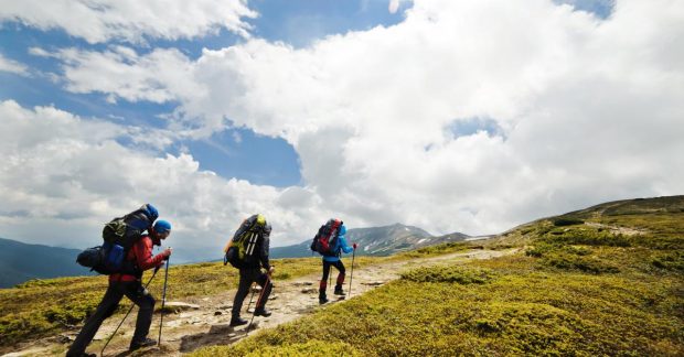
An increasing number of young hikers are finding themselves in dangerous situations by relying on Google Maps during mountain treks. Mountain rescue teams emphasize that the application is not designed for wilderness areas, as it fails to display critical terrain details such as steep cliffs, rocky outcrops, and the specifics of mountain trails.
Why smartphones can fail in the mountains
Unlike specialized maps, Google Maps does not provide an understanding of the three-dimensional shape of the terrain. Experts, including mountaineering instructor Pippa Archer, note that a paper map remains the most reliable tool. It does not require battery power and is not dependent on mobile signal stability, which is often unavailable in remote areas.
"A hiking map will show you where the ground gets really steep, where there are crags to avoid, or streams that need to be crossed," explains Pippa Archer.
The issue lies not only in the technology but also in the level of hiker training. Guide James Anstey emphasizes that the habit of using smartphones in urban environments creates a false sense of security. For safe hiking, experts advise mastering basic compass skills and using specialized applications like OS Maps or Outdooractive, which are specifically developed for hiking and trekking.
Source UNIAN — unian.ua/tourism/lifehacking/yak-oriyentuvatisya-na-miscevosti-pid-… ↗
Read next
 🩺Health
In Uzhhorod, Patient's Relative Attacks Emergency Medical Crew During Call
While assisting an injured resident in Uzhhorod, emergency medics were physically assaulted by the patient's brother. Patrol police were called to the scene to handle the…
 🇺🇦Ukraine
Italy Scandal: Deputy PM Demands Apology from Zelenskyy Over 'Myrotvorets' Website
Italian Deputy Prime Minister Matteo Salvini has demanded an apology from Ukrainian President Volodymyr Zelenskyy over the 'Myrotvorets' database, warning it could impact…
 🎭Culture & Sport
A new global trend is on the rise: What are 'fake weddings' and why are people celebrating without marriage
A growing trend of 'fake weddings' is spreading across Germany and globally, featuring full wedding ceremonies and receptions without any legal marriage registration.
 🏙️City
Melamine Sponges: How to Use Them Effectively Without Damaging Surfaces
We explore the specifics of using this popular cleaning tool, which acts as a gentle abrasive.
 🎭Culture & Sport
Astrological Myths and Reality: Birth Months Linked to a Calm Life
An overview of media claims connecting birth months to psychological comfort, accompanied by scientific caveats.
 ⚽Sport
Dramatic overtimes and favorite victories: how the latest Basketball Superleague matches ended
The regular championship matches of the Ukrainian Basketball Superleague featured bright comebacks, fierce leader battles, and crucial away victories.